


")


Descripción
Descripción del estado: Marcas de edad. Ver imágenes.
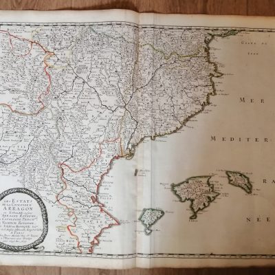
Medidas totales: 34.3×30.6cm. Medidas huella: 32.7x27cm. NO REPRODUCCIÓN ORIGINAL DE ÉPOCA. Beautiful 18th century map of Holland, Utrecht, Friesland, the Zuiderzee and parts of Gelderland, Brabant and Overijssel.
Hand-coloured copper engraving of Holland, published by Giambattista Albrizzi in Venice. Ca. 1740 in Atlante novissimo.
Title cartouche on the top left. Scale sticks on the bottom right. A compass rose is visible in the North Sea.
Cropped off short up to the edges. Margins were re-attached with old paper. Otherwise in good condition. Sharp print on clean paper. Folds are as published. Mapas Europa